1-Natural Hazards, 2- Tectonic Hazards, 3- Weather hazards 4-Cliamte change 5- Ecosystems, 6- Tropical rain forests 8- cold enviroments
- Created by: beckylilly
- Created on: 27-06-17 15:54
1-Natural Hazards
Natural hazard: A naturally occuring event which has an impact on people
Hazard risk: the chance of being affecdted by a natural event eg. frequency, wealth
Types:
- Tectonic - volcano
- Atmospheric- hurricane
- Geomorphological- Landlide
- Biological-
- Poverty- Can force people to live in these areas
- Urbanism- populated cities at risk
- Building on flood planes- rivers silt is good to build on
- climate change- warmer world so more energy and risk of intense storms ect.
2-Tectonic Hazards: Distribution
- Mainly occur at tectonic plate margins where plates are contantly moving due to convection currents from the earths core
Two types of earths crust:
Oceanic- Dense and thin crust
Contiental- Less dense but thick
2-Tectonic Hazards: Constructive Plate
- Two plates move apart
- Magma rises into the gap between them
- A volcano occurs as the magma breaks through the crust
- As the magma dries, it contsructs new land
2-Tectonic Hazards: Destructive Plate
- Two plates move towards each other
- Heavier, denser oceanic crust slides under the lighter, less dense continental crust
- The land is destroyed
- Friction between the pates builds up and causes an earthquake
- Magma rises and causes a composite volcano
Collision: When the plates meet and form a fold mountain
2-Tectonic Hazards: Conservative Plate
- Plates rub next to each other
- Causes a build up of pressure and friction on the outcrop of each plate and they get stuck on each other
- Eventually they move and cause an earthquake eg. San Andreas
- No volcano as there is no land destroyed or magma present
- the plates can move in the opposite or the same direction
2-Tectonic Hazards:Reducing the risk
Monitering:
Scientist are constantly monitering active volcanoes through: Remote sensing using satelites, Seismicity graphs of the earthqaukes, Geophysical measurements which detect changes of magma
Prediction:
Volcanoes are based on monitering and hotspot plate margin areas are identified through history
Protection:
Earth embankements can be used to divert lava from property. Earthquake resistant building can be made with shock absorbers in the floor and are built with strong materials.
Planning:
Maps have been produced to show the high risk areas to warn people
3- Weather Hazards- Global atmospheric circulation
The movement of air around the earth to balance the temperature
- Air sinks and forms areas of high pressure
- Air rises and forma areas of low pressure
- Winds move from areas of high pressure to low pressure
- Surface winds transport heat from one place to another
- Seasonal changes affect this pattern
3- Weather Hazards- How Tropical storms form
A tropical storm is a fast spinning storm with low pressure in the centre and strong winds which produce a spiral, thunderstorms and heavy rain
What a hurricane needs:
- Warm ocean water causing evaportaion and clouds
- Winds coming together forcing air up
- Wind flowing above storm
- Light winds outside to steer it
3- Weather Hazards- How Climate Change affects tro
Distribution:
- More moist air means storms are occuring more comonly
- Sea surface temperature has increased
Frequency:
- Thunder storms makes it warmer for tropical storms
- Scientist predict that storms wil decrease but the intensity will increase
- Risen sea level temperature make storms more common
Intensity:
- Moister air makes the storms more intense
- Stuck jet streams make storms bigger
3- Weather Hazards- Reducing the impacts
Monitering and Predicting:
- Windspeeds and and wind direction monitered
- temperature of sea level monitered
- We can then predict when it will occur
Planning:
- Have flood supplies eg, first aid
- Evacute areas and have them get flood insurance
- Everyone knows what to do
Protection:
- Stay inside safe buidings and low down, protect head
- buid houses on stilts and get flood insurance
- protects against death and injury
3- Weather Hazards- In the UK
Weather: Day to day conditions of the atmosphere
Climate: Average weather condition over a period of time
Uk extreme weather experiences:
Flooding, Heatwaves, Drought, Winds, Thunder stroms, Snow, Lighteneing, Fog, Ice
Why we experience them:
- Polar maritime: Cold, rain, moist, clouds
- Arctic maritime: Wet, cold, snow,
- Tropical maritime: Warm, hot, dry, rain, clouds
4- Climate change- Recent evidence
Rising sea level:
Global sea level has risen between 10 and 20 cm in the past 100 years. When the temperatures rise and freshwater ice melts, more water flows into the sea from the glaciers and ice caps. When the ocean warms up, it expands in volume- thermaexpansion
Seasonal changes:
Natural seasonal activities are advancing eg a study of birds nesting showed that more species of birds are neting on average 9 days earier than 20 years ago
Shrinking glaciers and melting ice caps:
Glaciers and ice caps over the world are shrinking and its estimated that some will completely disapear by 2035. Arctic sea ice has thinned by 65% since 1975
4- Climate change- Natural causes
Volcanic activity:
- Volcanoes blast out ash which block the sun reducing the temperature on earth
- Sulphur dioxide from volcanoes reflects the sunlight radiation redcuing sun on earth
Milankovitch cycles:
Eccentricity:
Paths of the earth orbitting the sun- can be closer or further away- hotter or colder
Precession:
The earths natural wobble making certain regions days shorter or longer
Axial tilt:
The earth is moving between two extremeties: 21.5-24.5 degrees- Making earth warmer or colder as the sun is at diffrent distances
4- Climate change- Human causes
Greenhouse effect:
- electromagnetic radiation , from the sun, passes through atmosphere
- earth absorbs radiation and warms up
- Some infrared radiation is absorbed by greenhouse gases trapped in atmosphere and warms up earth
Fossil fuels:
They produce co2- greenhouse gas: coal, oil, gas
Agriculture:
- Cows digestion produces methane (a greenhouse gas) and demands rising so more cows
- Rice paddy feilds invloves flooding feilds and decaying oganic matter makes methane
Deforestation:
Trees are carbon sinks so cutting them down makes more co2 left in the atmosphere
4- Climate change- Mitigation
Mitigating - reducing the severity
Carbon capture and storage:
- technology captures co2 from power station and is pumped to reservoirs
- eg, co2 Pipeline in norway
Alternating energy sources:
- So we cut down on fossil fuels and they dont produce co2 emissions
- eg. nuclear power station in summerset
Afforestation:
- Planting more trees to capture more co2 from enviroment during photosynthesis
- eg. amazon rainforest Brazil
International agreements:
- Countries agreeing to reduce co2 emissions eg. free public tansport in Paris
4- Climate change- Adaption
Changes in buildings:
- Bedzed is an eco community where the houses do not give off any carbon emissions
- eg, they use rain water to flush tiolets, thick walls for insulation
Changes in agricultural systems:
- New technology is being used to make extreme weather resistant crops eg, Gambia
Managing water supplies:
- Water saving tips for in the home eg, hippo bricks, turn off taps, take showers
- The himalayas melt and use glaciers as water in spring
- Thames distilation plant turns sea water into fresh water
Coping with rising sea level:
- Flood barriers eg, thames barrier shuts 5 times a year
- Bangladesh can't afford barriers so build houses on stilts instead or embankements
5- Ecosystems- Introduction
An ecosystems is a community of plants and animals which interact with each other and their physical enviroment
Biotic- Living features of an ecosystem eg. the plants/fish
Abiotic- Non living features of an ecosystem eg. the climate
Producer: Converts energy from the enviroment (sun) into sugars (glucose) eg. photosynthesis in plants
Consumer: Gets their energy from the producers
Decomposers: Breaks down animal and plant material into nutrients in the soil
5- Ecosystems- Food chains
A food chain is a diagram which shows the direct links between producers and consumers
A food web shows all the connections in a more complex way
5. Quaternary consumer eg. eagle
4. Tertairy consumer eg. snake
3. Secondary consumer eg. mouse
2. Primary consumer eg. insect
1. Primary producer eg. plant
5- Ecosystems- Fresh water pond
Pond bottom:
- Little light or oxygen, decomposers live here eg, water worms
Mid water:
- Fish are the main preditors here and breathe through gills
Pond surface:
- Lots of light and oxygen here and some animals here breathe through lungs
Above pond:
- Mainly birds live here and get their food from the pond surface
Pond margin:
- Lots of light, oxygen and shelter here, plants are eaten by small animals
5- Ecosystems- What causes change
Flooding is a physical problem and destroys habitats and affects the food chain
Draining ponds for farming affects fish and aquatic life and detroys habitats
Droughts dries up the siol and nutrients so primary consumers struggle to live
Pollution in ponds breaks down algae/producers and affects other species
Fertilizers can increase the nitrate which increases the growth of produers so oxygen levels decrease and fish may die - euthrophication
Climate change cannot provide suitable for conditions for producers growth so they struggle to grow and affects the rest of the food chain
Fires can burn and destroy small species and habitats which affects the rest of the food chain
Fish stocking can wipe out entire fish species and affects rest of food chain
5- Ecosystems- Nutrients cycling
When plants or animals die, decomposers recycle them into nutrients for other plants and animals. The decomposeres do not eat the waste but digest them by releasing enzymes which break them down and passes the nutirents into the soil. The plants them absorb the nutrientts and the primary consumer gets it.
5- Ecosystems- Global Biomes
Deciduos- medium temperature- North of the equator
Temperate grassland- hot summer/cold winter- North/South of equator
Coniferous forest- short summer- North of equator
Tundra- Frozen- Arctic
Tropicala rainforests-Hot/wet- South of equator
Savannah Grassland-grassy-South of equator
Mediterranien- hot/dry- Middle North of equator
Desert-Hot- On equator
6- Tropical Rainforests- Characteristics
Emergent Layer: Only a few trees and leaves are waxy to prevent drying eg. a monkey woud live here
Canopy: The trees knit together and form a dense canopy blocking out the sun and intercepting the rainfall eg. birds, monkeys
Understory: Low light, plants adapt to grow here- dense vegetation along the rivers eg. bird
Shrub layer: Only little light so plants grow slowly, covered in fall leaves and rotting brances- when trees fall, light gets in and encourages younger plants to grow eg. frogs, snake
Soil layer: Thin and poor and is only a shallow layer, infertile but is nutrients rich eg. insect
6- Tropical Rain-forests- Adaptations
Animals:
Gorillas- They have fur to keep them warm and protects against insects
Toucans- Have long beeks to reach fruit off trees and cut fruit off trees
Sloths- Hangs from trees and moves slowly to stay camouflaged
Plants:
Bark- Thin and smooth so water can flow off it easily
Leaves drip tip- Allows rain to drink off them, also waxy to encourage this
Buttresses- Ridges to support base of tree and large surface area for photosynthesis
6- Tropical Rain-forests- Values
BIODIVERSITY:
Home to over 50% of the worlds plants and animals species- important habitat
CLIMATE:
28% of the worlds oxygen is produced in rainforests and also acts as carbon sinks
RESOURCES:
Supplies are gathered from there- wood/paper, fruit and many medicines
INDIGENOUS TRIBES:
Home for many indigenous people- lots of tribal communities
6- Tropical Rain-forests- Sustainable Management
Selective logging
Clear felling is the most harmful method of deforestation. Selective logging is planning which trees are to be cut down by analysing their age, then, more trees are planted.
Conservation and education
Can be protected in nature reserve areas and can be used for education. Large companies financially support them in exchange for scientific research.
Ecotourism
Introducing tourism to the forests to raise money to protect them-susatinable
International agreements
Countries making plans and agreements to protect the eg. reducing demands of wood ect
Debt reduction
Countries borrow money and pay it back to the rainforest for afforestation programmes
7- Cold environments- Characteristics
POLAR:
- Winters fall below 50 degrees celsius
- Soil is permanently frozen
- Some plants like moss grow on fringes on the ice
- Polar bears have adapted to have thick fur to retain heat, black nose and feet pads to absorb sunshine
TUNDRA:
- Less cold winters and have high snow fall and short warm summers
- Soil is permafrost but top layer melts in summer, but mostly infertile
- Low plant growth but some small bushes in warmer areas
- Several animals can live here due to more food and less extreme climate eg. actic fox
7- Cold environments- Under threat
These enviroments have very fragile ecosystems which can be easily disturbed by humans and can take a very long time to recover
- touism
- coal mining
- fishing
- Energy development
Why it needs to be protected:
- Indigenous people live in peacfull, undistubed enviroments
- Home to many species of animals eg. penguins, polar bears, fish
- Vital for climate chane research as its an undeveloped, unpolluted area
- Beauty has potential for a tourism industry
- Povides small fishing industries
7- Cold environments- Management
Technology- The trans alaskan pipeline was made to transport oil across the arctic ocean
Goverment action-Ensures that companies delaing with oil must protect the natural enviroment and respect indienous people. Administrations protect marine enviroments from industrial fishing.
International agreements- Antarctic treaty is signed by many countries with the claims to protect th aera by controlling tourism and keeping it undisturbed and doing climate change research
Conservation groups- World Wildlife Fund is a conservation group to protect the enviroment and works with the communities to manage ecosystmes, supports science research and works with oil companies to keep them minimal.
-Glacial Landscapes
A glacier is a slow moving river of ice
- Since the last ice age the climate has become warmer so most glaciers melted
- Glaciers helped to create countryside today
- During the past ice age, the ice advanced and retreated
- Northern and eastern parts of the british isles were covered in ice
-Glaciation processes: EROSION
EROSION
Plucking:
- Melt water from a glacier freezes to the base of rock
- When the ice advances downhill (moves) rock is plucked from the back wall
- This leaves behind a jaggered rocky surface
Abrasion:
- When rock freezes to the base and back of a glacier
- When the glacier moves it scraped the rock like sandpaper
- These large scrathes are called striations
- this process creates u shaped valleys and leaves shiny rock surfaces
-Glaciation processes: WEATHERING
WEATHERING
Freeze-thaw:
- Melt water or rain water gets into cracks in the bed rock
- At night the water freezes and expands
- This causes the rock crack to increase and eventually breaks the rock
Factors affecting glacial abrasion
Velocity- The faster the glacier moves, the more friction between the rocks and glacier so more abrasion occurs
Ice thickness- The heavier the glacier, the more pressure and force on the rocks so more abrasion occurs
Basal debris- The more material there is frozen to the glacier, the more friction between the rocks so more arasion will occur
-Glaciation processes: MOVEMENT
MOVEMENT
Basal slip:
- In warmer areas eg the Alps, lots of melt water is produced
- This lubricates the glacier so it can slides down hills, easier
Rotational slip:
- In hollows on valley sides, glaciers can get stuck
- so to get out, they twist and rotate to get out of the hollow
- this erodes the hollow further
Internal deformation:
- In winter, the glaciers freeze to rock surfaces
- The weight of the ice causes individula ice crystal to form to stretch the glacier further down the mountain
-Glaciation processes: TRANSPORTATION
TRANSPORTATION
- Sediment transported by a glacier is called morraine
- It can be transported on or below the ice
- As a glacier moves forward, it pushes the sediment in front of it
- This is called bulldozing
-Glaciation processes: DEPOSITION
DEPOSITION
- Most depositioning occurs when ice melts
- Most ice melts at the snout of the glacier
- This is where most of the material from the ice is depositied
-Erosional land forms: U SHAPE VALLEY
U SHAPE VALLEY
Formation:
- Glacier moves down the valley and plucks rocks with it
- the rocks erode, deepen and widen the valley
- This creates a U-shape
Processes:
- Plucking
- Abrasion
-Erosional land forms: CORRIE
CORRIE
Formation:
- Snow compresses and forms a glacier
- This moves and hollows out the valley
- It then melts to produce a tarn (lake)
Processes:
- Plucking
- Abrasion
- Freeze thaw
-Erosional land forms: ARETE
ARETE
Formation:
- When glaciers on the sides of a ridge, erode and grind down the valley
- Forms a steepsided ridge like a knife edge
Processes:
- Plucking
- Abrasion
-Erosional land forms: PYRAMIDAL PEAK
PYRAMIDAL PEAK
Formation:
- When 3 or more corries cut backwards into the same mountain
- They form a sharp peak at the top of the mountain
Processes:
- abrasion
- Plucking
-Erosional land forms: TRUNCATED SPUR
TRUNCATED SPUR
Formation:
- Areas of land which are round at the top and steep at the bottom
- Formed when glaceirs move through the valley and cut off spurs
Processes:
- Abrasion
- Plucking
-Erosional land forms: HANGING VALLEY
HANGING VALLEY
Formation:
- smaller sided valley left hanging above the main Ushape valley
- This contains less ice than main glacial valley so not deeply eroded
Processes:
- Bulldozing
-Erosional land forms: RIBBON LAKE
RIBBON LAKE
Formation:
- Large norrow lake in a U shaped valley
- Forms in a hollow when a glacier has deeply eroded the less risistant rock and fills up with a valley
Processes:
- Abrasion
-Depositional landforms: MORAINE
A moraine is a type of landforma created when a glacier deposits its material and is made up of unsorted angular rocks, there are 4 types:
LATERAL: Material which has fallen from the sides of a valleyand builds up small ridges at the sides
MEDIAL: When two glaciers joint together, the sedimanet runs down the middle of the valley
GROUND:
Material left behind from a galcier and forms uneven hilly ground
TERMINAL: Material which piles up at the snout of the glacier and forms high ridges
-Depositional landforms: Diagrams of moraine
-Depositional landforms: DRUMLINS
DRUMLINS
- Formed of moraine
- They are elongated features
- They have blunt faces pointing up the valley
- They have pointed faces pointing down the valley
- The moraine moulds itslef around obsticles it faces
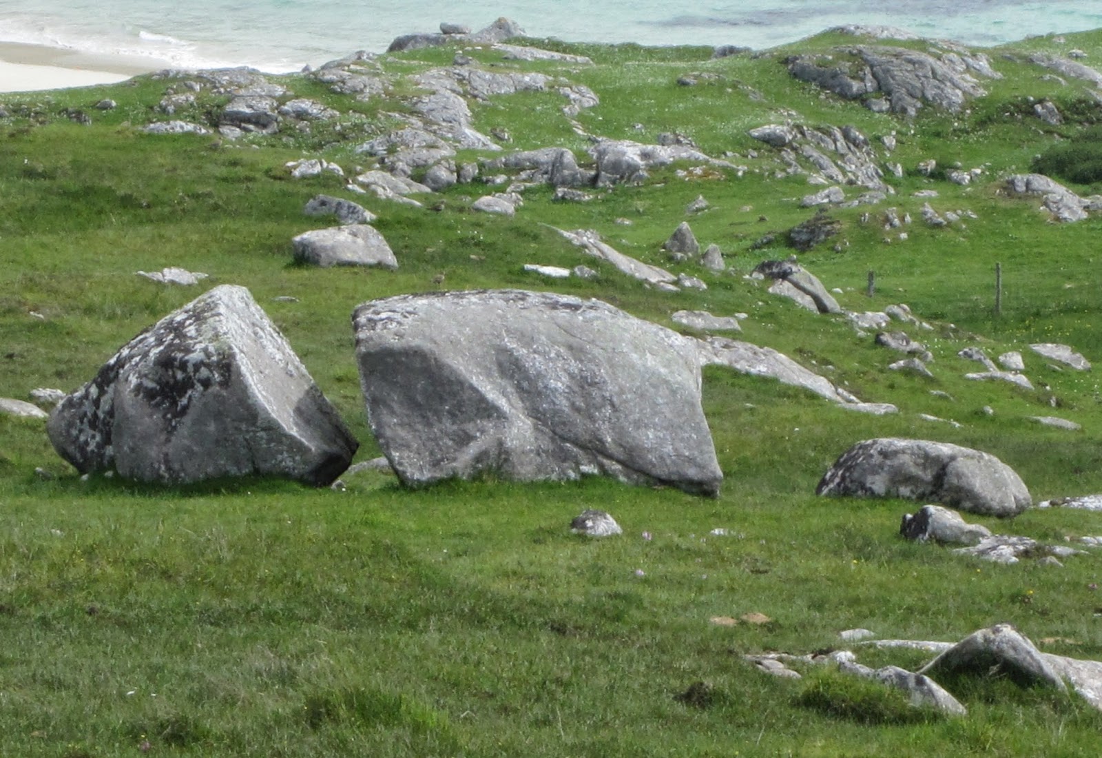
-Depositional landforms: ERRATICS
ERRATICS
- These are random rocks which are diffrent to all of the rocks around them
- They have been transported and deposited by a glacier
Related discussions on The Student Room
- geography natural hazards »
- Eduqas A-level Geography Component 1 (A110U10-1) - 17th May 2023 [Exam Chat] »
- AQA A Level Geography Paper 1 (7037/1) - 17th May 2023 [Exam Chat] »
- OCR A Level Geography Geographical debates H481/03 - 17 Jun 2022 [Exam Chat] »
- Edexcel A-Level Geography Paper 1 | [17th May 2023] Exam Chat »
- AQA A Level Geography Paper 1 7037/1 - 27 May 2022 [Exam Chat] »
- OCR A-Level Geography Geographical Debates | [12th June 2023] Exam Chat »
- A-level Geography Study Group 2022-2023 »
- can someone offer feedback on my 12 marker? Geog A level edexcel »
- Degrees »
Comments
Report