

River Landscapes
- Created by: megan_d2002
- Created on: 15-10-18 17:33
Drainage basin
Gorges Diagram

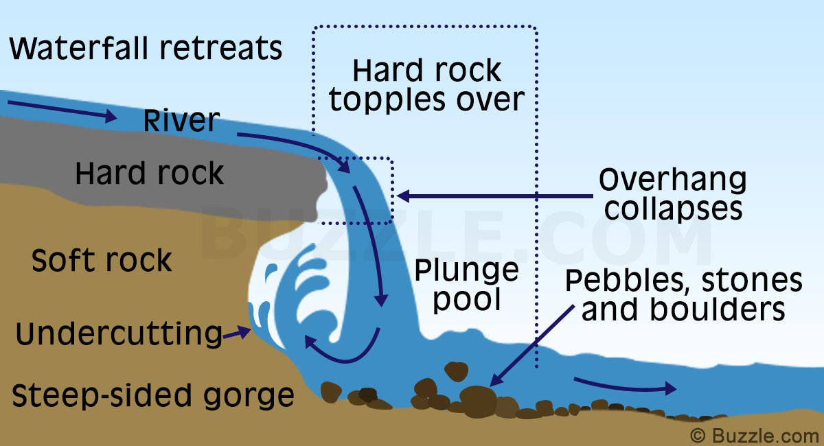
Waterfall Diagram
Meanders Diagram

River Landforms- Interlocking spurs
Interlocking spurs- mountain stream erodes vertically creating a V-shaped valley. It winds around areas of resistant rock to create them 
River Landforms- Ox-bow Lakes

Ox-bow lakes- As meanders migrate across the valley floor they erode towards eachother
River Landforms- Floodplains

Floodplains- wide, flat areas on either side of a river in its middle and lower courses. They are created by migrating meanders and floods depositing layers of silt to form alluvium.
River Landscapes- Levees
Levees- when, in low flow, deposition raises the river bed so the channel can't carry as much water. During flooding, water flows over the sides of the channel. As velocity decreases, coarser sediment is deposited first on the banks- then finer sand and mud, raising the height of the levees.
River Landforms- Estuaries
Estuary- where the river meets the sea. They are affected by tides, wave action and river processes. As the tide rises, rivers can't flow into the sea, so velocity falls and sediment is deposited forming mudflats, which develop into salt marshes.

Comments
No comments have yet been made