Autumn Geography Test

?

What is Geography?

Geography

- Learning about the world

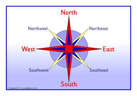
- Where places are - maps - directions - co ordinates

- What they are like - people and landscape

Physical Geography - What the landscape is like ? 

Landforms - Lakes, seas, beaches, rivers, volcanos, mountains, glaciers

Weather - clouds - weather patterns

Vegetation - rainforest, woodlands, deserts 

1 of 9

What is Geography?

Human Geography  - manmade

Population - different settlements - cities - towns - villages

Why are some places crowded?

Life styles - places

Settlements

City Problems

How people survive in different places e.g. deserts

Why are shops / houses where they are?

Economy

Why are some places wealthy?

Employment

2 of 9

What is Geography?

Population Geography - how many people are in an area.

                                  what the population is like.

Settlement Geography - how places develop, grow and chnage.

                                - how people live.

Economic Geography - How people make money.

Environmantal Geography- This is how people (human geography) affects nature (physical geography. In both positive and negative ways.

E.g  polution

deforestation

nature reserves

re planting

3 of 9

Continents and Oceans

7 continents of the world and their countries

4 of 9

Compass Points 8

Compass Points Posters (SB1182) - SparkleBox

5 of 9

Compass Points 16

Compass Rose 16 Point Geography Direction Secondary Bw RGB Illustration

6 of 9

Maps

A map - guides you to a certain place / location

Political Map - shows country boundaries (no physical features)

Physical Map - shows natural features - woods, mountains, rivers

Resource Map - show the natural resources in an area - fish, mines, farmland

Road Map - shows roads  - most used

Climate Map - shows climate zones and temperatures

Ordinance Survey Map - leisure use - shows roads, landscape, rivers, contours

7 of 9

Grid References and Scales

Grid References

Along the corridor (read the bottom number first)

Up the stairs (then up the side)

You read the line on the left and bottom of the square

Scale

Ratio of the size of an object on a map compare to it's size in the real world.

8 of 9

Contours

Contours

Contour line - connects points on a land surface of the same height.

                      Close together - steeper

                       Wide apart - shallow

Height is shown on a map by using different shades of colour

Relief - is the height and shape of the land

                  Circular Contour Pattern - dome shaped hill

                  V - shaped pattern - valley

9 of 9

Comments

No comments have yet been made

Similar Geography resources:

See all Geography resources »See all What is Geography? resources »