Weather Hazards!
- Created by: ethannnnnnnnn
- Created on: 14-01-18 16:44
Global Atmospheric Circulation...
Global atmospheric circulation - movement of air around the earth to try and and balance the temperature.
Main lines of lattitude -
Arctic circle
Tropic of Cancer
Tropic of Capricorn
Antarctic circle
Insolation - Incoming solar radiation
Winds blow from high to low pressure zones
Global Atmospheric Circulation...
Facts..
Desserts are never located on the equator
Earth axis tilted at 23.5 degrees
Cyclone - low pressure system
Anti Cyclone - high pressure system
Low pressure = bad weather
High pressure = good weather
Tropical Storms..
Distribution of tropical storms -
Known as Hurricane in Carribean sea and USA
Known as Typhoons in east Asia
Known as Cyclones in south Asia
Formation of tropical storms...
(seas must be at least 27 degrees! hot!!)
When a tropical storm reaches land it weakens - mainly costal damage (storm surges)
Tropical storms move away from the equator
Primary and Secondary effects...
Primary -
With winds over 200km/h there is
widespread damage to trees, crops and insecure buildings which can explode as pressure changes - flying debris.
Instense rainfall can cause flooding
Costal damage from storm surge
Secondary -
Damage to property, loss of life, homelessness
looting
damaged roads and railways, comms lines, costal damage, looting
Forecasting and tracking storms...
Satelllites - use infared images
National Hurricane Centre, California - makes predictions of where hurricanes may hit land, issues hurricane watch and hurricane warnings.
Ships record water temperatures
Aircraft - flying close to storms gather info on intensity
Radar - tracks info on route and rainfall
Building defences...
Levees and flood walls - protects against storm surge
Houses walls and roofs can be strenghtened
New housing built further away from risk ares
Houses with flooding risk built on stilts
Improving sanitation
Protecting people...
Prediction
Planning - authorites in area, have equipment ready, evacuation routes.
Defences - Window borders, defence shelters
Education - Well educated, schools to have emergency equipment.
Hurricane Katrina - New Orleans
Hurrincane Katrina - New Orleans
Hurricane Katrina - New Orleans
- 23rd August, 2005
- New Orleans was below sea level - flooding was a major issue
- 80% of New Orleans was flooded
- 10,000 made homeless
- 3 million without electricity
- Damaged properties - high winds
- flooding - storm surges
- 2 bridges/ roads collapsed
- 23% didn't return to New Orleans 5 years after Hurricane.
- Repair costs - $200 billion
- Defences:
- Sea walls - Not effective!
- Few buildings had boerderd windows
- Levees
- Tape on windows
- 18,000 people evacuating New Orleans per hour!! before the storm
Weather Hazards in the Uk
Weather Hazards in the Uk
Weather Hazards in the Uk
Weather - day to day conditions of the atmosphere.
Climate - avarage weather over a longer period of time.
Hazards in the United Kingdom:
Drought and heat - Rivers and resovours can dry up and become low, affecting water supply and wildlife. Heat waves effect the elderly.
Thunderstorms - Follow a period of hot weather, torrential rain fall, flash floods
Prolonged rainfall - long periods of rain, river floods. Common in winter/ spring. Snowmelt makes matters worse!
Air masses...
Somerset level floods!
Somerset level floods!

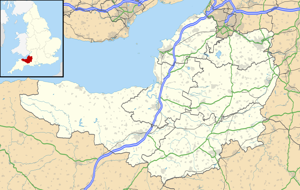
Where are the somerset levels?
South west of UK
To the east of somerset is Deven
To the south of somerset is Dorset

Prone to flooding - flat land and many rivers, wetland and costal plain
Causes..
prolonged rainfall - winter 2013-14
wetest January since 1910
areas of low pressure swept accross Atlantic
350mm of rainfall fell in January and Febuary
High tides and storm surges from rivers up the Bristol channel
Rivers HAD NOT been dredged for at least 20 years!! - WHAT!?
IMPACTS..
Social - 600 houses flooded, 16 farms eveacuated, Villages cut off, some evacuated to temp accomodation, power supplies cut off, road closures.
Economic - £10 million repair, agricultural land under water for 3-4 weeks, 1000+ livestock evacuated, Railway lines closed, local businesses lost trade
Environmental - Floodwaters contaminated with sewage, debris had to be cleared, water had to be reoxygenated before being pumped back into rivers.
Respnses...
Imidiate responses - Rescue boats deployed,
extra police patrol,
flood action plan £20mil,
Royal Marines help,
Uk gov gave £30 mil,
villagers used boats to get to school e.t.c
Responses...
Long term responses -
8km of rivers were dredged
Road levels raised
flood defences in communirties
River banks raised and strengthened
Pumps borrowed from Netherlands.
Is the weather in the UK becoming more extreme?
Evidence:
2015/16 - very wet, severe storms in Yorkshire and the North
2010 - heavy snow, temperatures of -18 degrees
2003 - heatwave, Kent, 2000 died, temperatures of 38.5 degrees
2008 - floods, Somerset
2009 - heavy snow - heavy floods, cambria lake
IPCC (Intergovournmental panel on climate change) in 2011 agreed extreme world weather becomes more common as global warming heats the planet.
Weather patterns getting stuck?
Due to the changing jet streams weather patterns may be getting stuck explaining the long periods of weather.
Climate change
Climate change...
Climate change
Long term change in weather.
The period of timeline that spans from now until 2.6million years ago is known as the quaternary period
Related discussions on The Student Room
- geography natural hazards »
- Eduqas A-level Geography Component 1 (A110U10-1) - 17th May 2023 [Exam Chat] »
- case studies for ocr gcse geography b »
- Alevel geography hazard 20 marker »
- AQA A Level Geography Paper 1 (7037/1) - 17th May 2023 [Exam Chat] »
- Geography Bsc modules »
- DVSA App or Theory Test 4 in 1 App »
- EPQ topic »
- OCR A-Level Geography Geographical Debates | [12th June 2023] Exam Chat »
- OCR A Level Geography Geographical debates H481/03 - 17 Jun 2022 [Exam Chat] »
Comments
No comments have yet been made